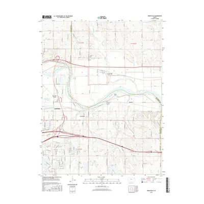
2016 Map of Grantville
USGS Topo · Published 2016About this map
The Kansas River winds through the heart of this landscape, separating the established community of Tecumseh from Grantville to the north. This riparian corridor is defined by complex water systems, including Franks Island and several meandering tributaries such as Muddy Cr and Whetstone Cr. To the west, the eastern edge of Topeka is visible, dominated by the Philip Billard Municipal Airport and the junction of Shunganunga Creek with its older channel.
Find a feature on this map
115 named features on this map. Tap any name to fly to it.
Don’t see what you’re looking for? This feature index may not catch every label — zoom into the map to look around manually.
Map Details
Editions of this 2016 Grantville Map
This is the sole edition of this map. No revisions or reprints were ever made.
Other maps of this area

1885 · Lawrence
USGS Topo · 1:125,000

1886 · Oskaloosa
USGS Topo · 1:125,000

1888 · Oskaloosa
USGS Topo · 1:125,000

1889 · Burlingame
USGS Topo · 1:125,000

1889 · Topeka
USGS Topo · 1:125,000

1889 · Lawrence
USGS Topo · 1:125,000

1894 · Burlingame
USGS Topo · 1:125,000

1894 · Oskaloosa
USGS Topo · 1:125,000

1894 · Topeka
USGS Topo · 1:125,000

1947 · Lawrence
USGS Topo · 1:250,000