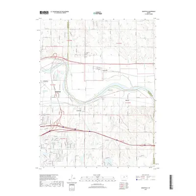
2018 Map of Grantville
USGS Topo · Published 2018About this map
The Kansas River flows through this corner of northeast Kansas, shaping the geography of Topeka and its eastern surroundings. North of the river, the settlement of Grantville sits amidst a network of rural routes including NE Calhoun Bluff Rd and 21st St. This area is particularly rich for local history research, featuring the Grantville Cem and the Old Grantville Cem located near the small drainage of Little Muddy Cr. South of the riverbank, the communities of Tecumseh and Spencer are situated along the plains, while the Philip Billard Municipal Airport occupies the land where the Shunganunga Creek and its old channel converge with the primary river valley. Numerous smaller waterways like Whetstone Cr and Stinson Cr carve through the landscape, illustrating the drainage patterns that defined local land use and development.
Find a feature on this map
71 named features on this map. Tap any name to fly to it.
Don’t see what you’re looking for? This feature index may not catch every label — zoom into the map to look around manually.
Map Details
Editions of this 2018 Grantville Map
This is the sole edition of this map. No revisions or reprints were ever made.
Other maps of this area

1885 · Lawrence
USGS Topo · 1:125,000

1886 · Oskaloosa
USGS Topo · 1:125,000

1888 · Oskaloosa
USGS Topo · 1:125,000

1889 · Burlingame
USGS Topo · 1:125,000

1889 · Topeka
USGS Topo · 1:125,000

1889 · Lawrence
USGS Topo · 1:125,000

1894 · Burlingame
USGS Topo · 1:125,000

1894 · Oskaloosa
USGS Topo · 1:125,000

1894 · Topeka
USGS Topo · 1:125,000

1947 · Lawrence
USGS Topo · 1:250,000