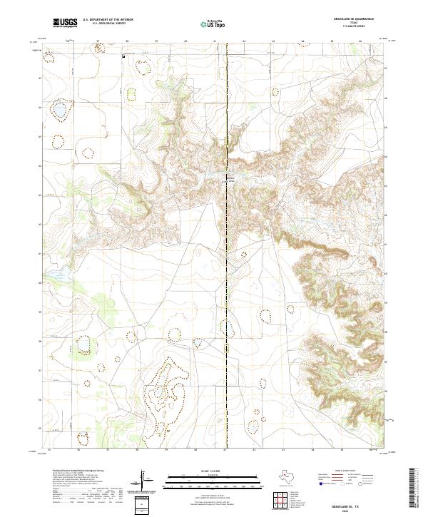
2022 Map of Grassland SE
USGS Topo · Published 2022About this map
The Double Mountain Fork Brazos River carves a complex network of canyons and draws across this West Texas landscape, most notably the deeply eroded Buffalo Soldier Draw. This 2022 survey captures the stark transition from the high, flat cotton country of the Llano Estacado to the rugged breaks at the headwaters of the Brazos. Near the northern boundary, the Grassland Cem stands as a focal point for local family history, situated just off a grid of county roads including Co RD 26 and Co RD FF. The terrain is punctuated by ephemeral features like Stewart Lake, reflecting the semi-arid hydrology of the region. Spanning the Lynn Co and Garza Co line, the map documents the intersection of modern ranching and agricultural access roads like FM 1313 with the natural drainage systems that define this part of the South Plains.
Find a feature on this map
20 named features on this map. Tap any name to fly to it.
Don’t see what you’re looking for? This feature index may not catch every label — zoom into the map to look around manually.
Map Details
Editions of this 2022 Grassland SE Map
This is the sole edition of this map. No revisions or reprints were ever made.
Other maps of this area

1954 · Lubbock
USGS Topo · 1:250,000

1954 · Big Spring
USGS Topo · 1:250,000

1958 · Big Spring
USGS Topo · 1:250,000

1969 · Beal Hollow
USGS Topo · 1:24,000

1969 · Indian Canyon NE
USGS Topo · 1:24,000

1969 · Grassland SE
USGS Topo · 1:24,000

1969 · Post West
USGS Topo · 1:24,000
1969 · Middle Creek
USGS Topo · 1:24,000

1970 · New Lynn
USGS Topo · 1:24,000
1970 · Draw
USGS Topo · 1:24,000