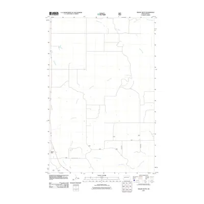
2011 Map of Grassy Butte
USGS Topo · Published 2011About this map
Grassy Butte serves as the primary focal point in this 2011 survey of western North Dakota, situated at the intersection of local and forest service routes. The landscape is defined by an intricate drainage system, with Crosby Creek and Charlie Bob Creek carving through the terrain. A network of specific rural routes, including Charlie Bob Creek Rd and various numbered forest service roads like 8206 and 8202, reveal the infrastructure necessary for land management and ranching in this part of McKenzie County. The map captures a moment of transition where established drainage names such as Russian Creek and Lone Butte Creek meet the modern numbered road system, offering a detailed perspective on the region's topographical and logistical layout.
Find a feature on this map
15 named features on this map. Tap any name to fly to it.
Don’t see what you’re looking for? This feature index may not catch every label — zoom into the map to look around manually.
Map Details
Editions of this 2011 Grassy Butte Map
This is the sole edition of this map. No revisions or reprints were ever made.
Other maps of this area

1953 · Watford City
USGS Topo · 1:250,000

1957 · Watford City
USGS Topo · 1:250,000

1958 · Long X Divide
USGS Topo · 1:24,000

1958 · Lone Butte SE
USGS Topo · 1:24,000

1958 · Lone Butte
USGS Topo · 1:24,000

1967 · Watford City
USGS Topo · 1:250,000

1974 · Grassy Butte SW
USGS Topo · 1:24,000

1974 · Petes Creek
USGS Topo · 1:24,000

1974 · Buckskin Butte
USGS Topo · 1:24,000
1974 · Scairt Woman Draw
USGS Topo · 1:24,000