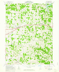
1962 Map of Gratiot
USGS Topo · Published 1963About this map
The rugged topography of Flint Ridge dominates this area, where the border of Licking and Muskingum counties meets the township of Madison. This 1960s landscape is defined by the transition from agricultural plateaus to the deep-cut valleys of Poverty Run, Kent Run, and Thompson Run. Central to the map is the village of Gratiot, a crossroads settlement along the primary east-west corridor, flanked by the community of Mt Sterling.
Find a feature on this map
34 named features on this map. Tap any name to fly to it.
Don’t see what you’re looking for? This feature index may not catch every label — zoom into the map to look around manually.
Map Details
Editions of this 1962 Gratiot Map
3 editions found
Other maps of this area

1909 · Newark
USGS Topo · 1:62,500

1909 · Thornville
USGS Topo · 1:62,500

1910 · Frazeysburg
USGS Topo · 1:62,500

1910 · Zanesville
USGS Topo · 1:62,500

1947 · Columbus
USGS Topo · 1:250,000

1950 · Marion
USGS Topo · 1:250,000

1961 · Columbus
USGS Topo · 1:250,000

1961 · Hanover
USGS Topo · 1:24,000

1961 · Zanesville West
USGS Topo · 1:24,000
1961 · Fultonham
USGS Topo · 1:24,000