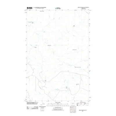
2011 Map of Graveyard Hill
USGS Topo · Published 2011About this map
Graveyard Hill and the surrounding terrain of Prairie County define this stretch of Montana ranchland. The landscape is marked by a network of drainage features including Kelly Draw, Maggie Draw, and Pine Hill Draw, all of which feed into the meandering course of Cedar Creek. Water management is central to the area's utility, evidenced by a series of small-scale reservoirs and infrastructure like the Little Gertison Dam at Little Garrison Reservoir and the JJ Blakenship Number 3 Dam.
Find a feature on this map
18 named features on this map. Tap any name to fly to it.
Don’t see what you’re looking for? This feature index may not catch every label — zoom into the map to look around manually.
Map Details
Editions of this 2011 Graveyard Hill Map
This is the sole edition of this map. No revisions or reprints were ever made.
Other maps of this area

1953 · Miles City
USGS Topo · 1:250,000

1957 · Miles City
USGS Topo · 1:250,000

1958 · Miles City
USGS Topo · 1:250,000
1967 · Upper Magpie Reservoir
USGS Topo · 1:24,000

1967 · Twin Forks Reservoir
USGS Topo · 1:24,000

1981 · Dorothy Draw
USGS Topo · 1:24,000

1981 · Ayer Spring NE
USGS Topo · 1:24,000

1981 · Rocking Chair Butte
USGS Topo · 1:24,000

1981 · Wibaux
USGS Topo · 1:100,000

1982 · Hodges
USGS Topo · 1:24,000