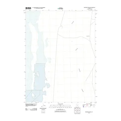
2010 Map of Grayback Hills
USGS Topo · Published 2010About this map
The Grayback Hills define the arid, open landscape of this Tooele County region as documented in 2010. This desert terrain is characterized by long, distinct topographical features like Thumb Ridge and Pinky Ridge, which stretch across the central portion of the map. To the east, the broad expanse of Ripple Valley suggests a typical Great Basin drainage pattern, where sparse vegetation and seasonal runoff shape the earth.
Find a feature on this map
4 named features on this map. Tap any name to fly to it.
Don’t see what you’re looking for? This feature index may not catch every label — zoom into the map to look around manually.
Map Details
Editions of this 2010 Grayback Hills Map
This is the sole edition of this map. No revisions or reprints were ever made.
Other maps of this area

1953 · Tooele
USGS Topo · 1:250,000

1955 · Tooele
USGS Topo · 1:250,000

1973 · Ripple Valley
USGS Topo · 1:24,000

1973 · Grassy Mountains
USGS Topo · 1:24,000

1973 · Knolls 2 NE
USGS Topo · 1:24,000

1973 · Knolls
USGS Topo · 1:24,000

1973 · Aragonite NW
USGS Topo · 1:24,000

1973 · Grayback Hills
USGS Topo · 1:24,000

1973 · Finger Ridge
USGS Topo · 1:24,000
1973 · Aragonite
USGS Topo · 1:24,000