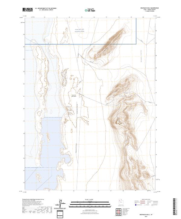
2023 Map of Grayback Hills
USGS Topo · Published 2023About this map
The Utah Test and Training Range dominates this portion of the Great Salt Lake Desert, where military logistics and desolate landforms meet. The topography is defined by the isolated elevations of the Grayback Hills, which include the distinctively named Pinky Ridge and Thumb Ridge. These features rise sharply from the surrounding flats, creating a stark vertical contrast against the expansive white crust of the salt desert.
Find a feature on this map
18 named features on this map. Tap any name to fly to it.
Don’t see what you’re looking for? This feature index may not catch every label — zoom into the map to look around manually.
Map Details
Editions of this 2023 Grayback Hills Map
This is the sole edition of this map. No revisions or reprints were ever made.
Other maps of this area

1953 · Tooele
USGS Topo · 1:250,000

1955 · Tooele
USGS Topo · 1:250,000

1973 · Ripple Valley
USGS Topo · 1:24,000

1973 · Grassy Mountains
USGS Topo · 1:24,000

1973 · Knolls 2 NE
USGS Topo · 1:24,000

1973 · Knolls
USGS Topo · 1:24,000

1973 · Aragonite NW
USGS Topo · 1:24,000

1973 · Grayback Hills
USGS Topo · 1:24,000

1973 · Finger Ridge
USGS Topo · 1:24,000
1973 · Aragonite
USGS Topo · 1:24,000