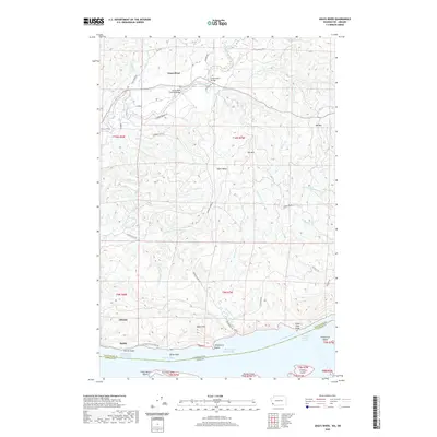
2020 Map of Grays River
USGS Topo · Published 2020About this map
Grays River and its intricate riverine geography define this 2020 topographic record of Wahkiakum County. The landscape transitions from the high ridges of Elk Mtn and KM Mtn down through the drainage basins of Crooked Creek and Klints Cr to the expansive Columbia River shoreline. A primary local landmark, the Grays River Covered Bridge, stands as a centerpiece of the inland settlement pattern, while the coastal edge is marked by small communities like Altoona and Dahlia. The map details the complex maritime environment of the river's lower reaches, including Welch Island Reach, the Jim-Crow Sands, and prominent navigation points such as Pillar Rock and Three Tree Point. This modern survey reflects the enduring rural character of southwestern Washington, where timbered hills meet tidal influence near the mouth of the Columbia.
Find a feature on this map
64 named features on this map. Tap any name to fly to it.
Don’t see what you’re looking for? This feature index may not catch every label — zoom into the map to look around manually.
Map Details
Editions of this 2020 Grays River Map
This is the sole edition of this map. No revisions or reprints were ever made.
Other maps of this area

1940 · Svensen
USGS Topo · 1:62,500

1940 · Brookfield
USGS Topo · 1:62,500

1941 · Skamokawa
USGS Topo · 1:62,500

1941 · Cathlamet
USGS Topo · 1:62,500

1949 · Upper Naselle River
USGS Topo · 1:24,000

1949 · Cathlamet Bay
USGS Topo · 1:24,000

1949 · Rosburg
USGS Topo · 1:24,000

1953 · Hoquiam
USGS Topo · 1:250,000

1953 · Skamokawa
USGS Topo · 1:62,500

1953 · Cathlamet
USGS Topo · 1:62,500