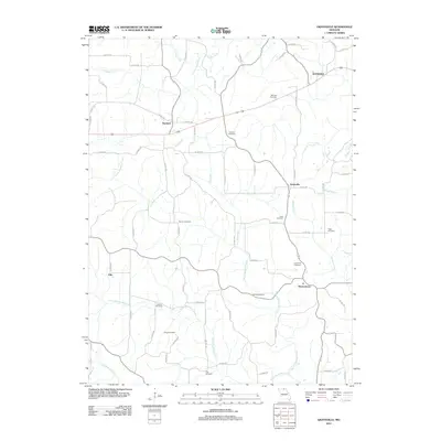
2012 Map of Graysville
USGS Topo · Published 2012About this map
Hartford and Graysville sit within a landscape defined by an extensive network of small cemeteries and winding creek branches in northern Missouri. This survey from the early 2010s reveals a rural pattern of development where family and community burial grounds, such as Lone Pine Cemetery and McCune Cemetery, are scattered among the headwaters of numerous streams. The drainage system is particularly dense here, featuring the various forks of North Blackbird Creek, South Blackbird Creek, and Wildcat Creek. To the north, the settlement of Glendale marks the upper reaches of the map near Sandy Creek, while Elko and Martinstown anchor the southern portions. This map serves as an essential tool for genealogists, as it meticulously labels nearly a dozen distinct cemeteries, including Bunker Cemetery, Rose Cemetery, and Young Cemetery, providing precise locations for local family research.
Find a feature on this map
73 named features on this map. Tap any name to fly to it.
Don’t see what you’re looking for? This feature index may not catch every label — zoom into the map to look around manually.
Map Details
Editions of this 2012 Graysville Map
This is the sole edition of this map. No revisions or reprints were ever made.
Other maps of this area

1911 · Queen City
USGS Topo · 1:62,500

1912 · Green City
USGS Topo · 1:62,500

1913 · Queen City
USGS Topo · 1:62,500

1914 · Green City
USGS Topo · 1:62,500

1939 · Centerville
USGS Topo · 1:62,500

1941 · Centerville
USGS Topo · 1:62,500

1954 · Centerville
USGS Topo · 1:250,000

1957 · Centerville
USGS Topo · 1:250,000

1958 · Centerville
USGS Topo · 1:250,000
1974 · Green City NW
USGS Topo · 1:24,000