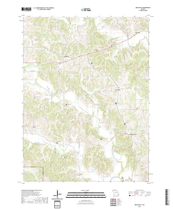
2021 Map of Graysville
USGS Topo · Published 2021About this map
Graysville and the surrounding rural uplands of northern Missouri appear here in a landscape defined by deeply dissected creek valleys and scattered agricultural settlements. The terrain is structured by the many branches of the Blackbird Creek system, including the N Blackbird Cr and S Blackbird Cr, which have carved intricate drainage patterns through the plateau. Small, historical community centers like Martinstown and Hartford serve as anchors for the local road network, while the southern edge of the map follows the boundary between Putnam Co and Sullivan Co along Shuteye Cr.
Find a feature on this map
46 named features on this map. Tap any name to fly to it.
Don’t see what you’re looking for? This feature index may not catch every label — zoom into the map to look around manually.
Map Details
Editions of this 2021 Graysville Map
This is the sole edition of this map. No revisions or reprints were ever made.
Other maps of this area

1911 · Queen City
USGS Topo · 1:62,500

1912 · Green City
USGS Topo · 1:62,500

1913 · Queen City
USGS Topo · 1:62,500

1914 · Green City
USGS Topo · 1:62,500

1939 · Centerville
USGS Topo · 1:62,500

1941 · Centerville
USGS Topo · 1:62,500

1954 · Centerville
USGS Topo · 1:250,000

1957 · Centerville
USGS Topo · 1:250,000

1958 · Centerville
USGS Topo · 1:250,000
1974 · Green City NW
USGS Topo · 1:24,000