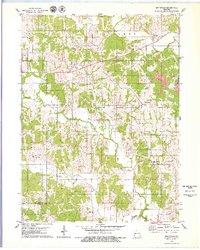
1979 Map of Graysville
USGS Topo · Published 1979About this map
Hartford and Graysville center this portrait of northern Missouri, where the landscape is defined by the branching tributaries of North Blackbird Creek and South Blackbird Creek. The map records a rural infrastructure deeply tied to family and local history, evidenced by the numerous small burial grounds such as Bunker Cem, McCune Cem, and Johnson Cem that dot the townships of Liberty and Elm.
Find a feature on this map
32 named features on this map. Tap any name to fly to it.
Don’t see what you’re looking for? This feature index may not catch every label — zoom into the map to look around manually.
Map Details
Editions of this 1979 Graysville Map
This is the sole edition of this map. No revisions or reprints were ever made.
Other maps of this area

1911 · Queen City
USGS Topo · 1:62,500

1912 · Green City
USGS Topo · 1:62,500

1913 · Queen City
USGS Topo · 1:62,500

1914 · Green City
USGS Topo · 1:62,500

1939 · Centerville
USGS Topo · 1:62,500

1941 · Centerville
USGS Topo · 1:62,500

1954 · Centerville
USGS Topo · 1:250,000

1957 · Centerville
USGS Topo · 1:250,000

1958 · Centerville
USGS Topo · 1:250,000
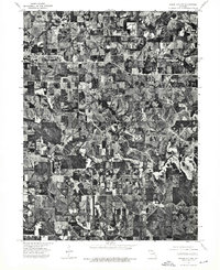
1974 · Green City NW
USGS Topo · 1:24,000