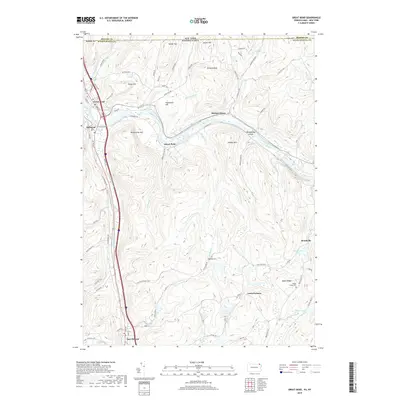
2019 Map of Great Bend
USGS Topo · Published 2019About this map
The Susquehanna River carves a sharp path through the northern reaches of the Pennsylvania-New York border, defining the landscape between Great Bend and Hallstead. This modern terrain profile illustrates how the river's winding course created prominent landforms like Island Plain and Woodbridge Island, which stand in contrast to the surrounding peaks of Maunatome Mtn and Smokey Mtn. To the south, the village of New Milford sits along the Salt Lick Creek valley, connected to upland hamlets such as Lewis Corners and Brushville. Local history is anchored by rural landmarks including Highland Cem and Maple Ridge Cem, alongside several small bodies of water like Brushville Lake and Fullers Lake that dot the high ridges of Susquehanna County.
Find a feature on this map
48 named features on this map. Tap any name to fly to it.
Don’t see what you’re looking for? This feature index may not catch every label — zoom into the map to look around manually.
Map Details
Editions of this 2019 Great Bend Map
This is the sole edition of this map. No revisions or reprints were ever made.
Other maps of this area

1904 · Binghamton
USGS Topo · 1:62,500

1905 · Nineveh
USGS Topo · 1:62,500

1932 · Susquehanna
USGS Topo · 1:62,500

1935 · Susquehanna
USGS Topo · 1:62,500

1937 · Binghamton East
USGS Topo · 1:24,000

1942 · Binghamton East
USGS Topo · 1:31,680

1943 · Montrose
USGS Topo · 1:62,500

1945 · Montrose
USGS Topo · 1:62,500

1948 · Binghamton
USGS Topo · 1:250,000

1950 · Binghamton
USGS Topo · 1:250,000