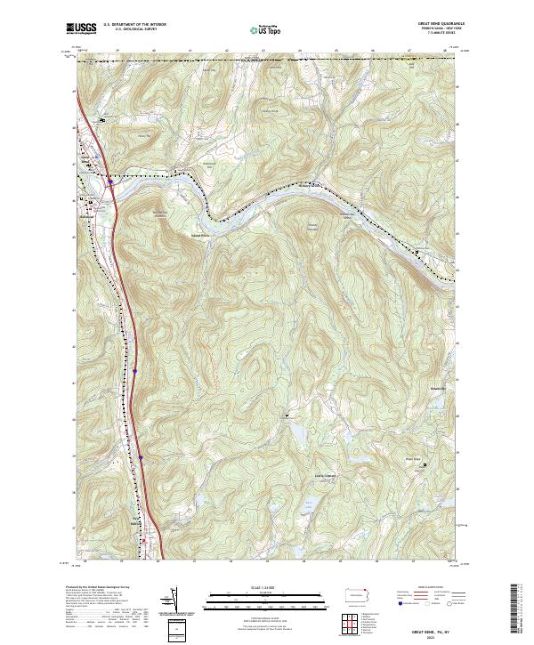
2023 Map of Great Bend
USGS Topo · Published 2023About this map
The Susquehanna River carves a dramatic U-shaped path through this terrain, defining the local geography around the twin settlements of Great Bend and Hallstead. This modern topographical study illustrates the deep connection between the river valley and the transportation corridors that follow it, including the Susquehanna River Water Trail and numerous roads tracing the shoreline. The surrounding uplands are dominated by distinctive peaks such as Maunatome Mountain, Smokey Mountain, and Penny Hill. Genealogists will find a high density of burial sites across the landscape, ranging from the Great Bend Episcopal Cem in town to rural locations like Highland Cem and McKune Cem near the New York border. The transition from valley floor to ridges like Maple Ridge is marked by numerous small tributaries including Salt Lick Creek and Mitchell Creek, which feed the river system.
Find a feature on this map
101 named features on this map. Tap any name to fly to it.
Don’t see what you’re looking for? This feature index may not catch every label — zoom into the map to look around manually.
Map Details
Editions of this 2023 Great Bend Map
This is the sole edition of this map. No revisions or reprints were ever made.
Other maps of this area

1904 · Binghamton
USGS Topo · 1:62,500

1905 · Nineveh
USGS Topo · 1:62,500

1932 · Susquehanna
USGS Topo · 1:62,500

1935 · Susquehanna
USGS Topo · 1:62,500

1937 · Binghamton East
USGS Topo · 1:24,000

1942 · Binghamton East
USGS Topo · 1:31,680

1943 · Montrose
USGS Topo · 1:62,500

1945 · Montrose
USGS Topo · 1:62,500

1948 · Binghamton
USGS Topo · 1:250,000

1950 · Binghamton
USGS Topo · 1:250,000