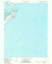
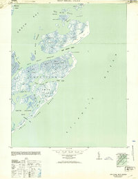
1968 Map of Great Machipongo Inlet
USGS Topo · Published 1980About this map
Cobb Island and the southern tip of Hog Island dominate this coastal survey of Northampton County, illustrating the dynamic barrier islands of Virginia's Eastern Shore. The map documents a shifting maritime landscape where the Atlantic Ocean meets the intricate waterways of Hog Island Bay. The prominent Great Machipongo Inlet serves as the primary passage between the islands, fed by a network of deep-water paths including North Channel and Rowes Hole Channel.
Find a feature on this map
10 named features on this map. Tap any name to fly to it.
Don’t see what you’re looking for? This feature index may not catch every label — zoom into the map to look around manually.
Map Details
Editions of this 1968 Great Machipongo Inlet Map
4 editions found
Other maps of this area

1941 · Broadwater
USGS Topo · 1:62,500

1942 · Cobb Island
USGS Topo · 1:24,000

1942 · Great Machipongo Inlet
USGS Topo · 1:24,000

1942 · Little Machipongo Inlet
USGS Topo · 1:24,000

1942 · Nassawadox
USGS Topo · 1:24,000

1943 · Nassawadox
USGS Topo · 1:31,680

1946 · Eastville
USGS Topo · 1:250,000
1953 · Ship Shoal Inlet
USGS Topo · 1:24,000

1961 · Eastville
USGS Topo · 1:250,000

1966 · Eastville
USGS Topo · 1:250,000