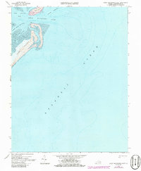
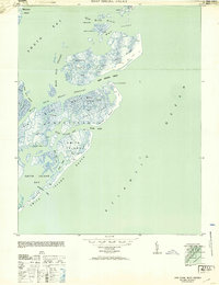
1968 Map of Great Machipongo Inlet
USGS Topo · Published 1986About this map
Cobb Island and Hog Island anchor the northern reaches of this coastal survey, where the shifting sands of the Virginia barrier islands meet the Atlantic Ocean. The map documents a complex maritime environment dominated by the Great Machipongo Inlet, a critical passage for local navigation between the open sea and the protected waters of Hog Island Bay. The intricate network of tidal waterways, including North Channel and Rowes Hole Channel, reveals the dynamic nature of this shoreline before late-20th-century shifts. A notable landmark, Aycock, is positioned near a Light on the northern tip of Cobb Island, providing a fixed point of reference in an otherwise fluid landscape of shifting inlets and expansive tidal flats. This 1968 data, updated with 1982 aerial photography, captures the coastal topography and hydrography as it existed in the mid-to-late 20th century.
Find a feature on this map
12 named features on this map. Tap any name to fly to it.
Don’t see what you’re looking for? This feature index may not catch every label — zoom into the map to look around manually.
Map Details
Editions of this 1968 Great Machipongo Inlet Map
4 editions found
Other maps of this area

1941 · Broadwater
USGS Topo · 1:62,500

1942 · Cobb Island
USGS Topo · 1:24,000

1942 · Great Machipongo Inlet
USGS Topo · 1:24,000

1942 · Little Machipongo Inlet
USGS Topo · 1:24,000

1942 · Nassawadox
USGS Topo · 1:24,000

1943 · Nassawadox
USGS Topo · 1:31,680

1946 · Eastville
USGS Topo · 1:250,000
1953 · Ship Shoal Inlet
USGS Topo · 1:24,000

1961 · Eastville
USGS Topo · 1:250,000

1966 · Eastville
USGS Topo · 1:250,000