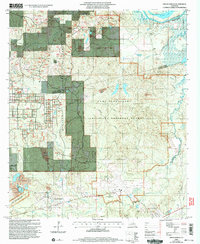
2003 Map of Green Gables
USGS Topo · Published 2005About this map
The Kisatchie National Forest dominates much of this landscape, where the boundary of Camp Beauregard meets the lowlands of central Louisiana. This map documents a transition from the structured military grounds of the Louisiana National Guard at Esler Field and the surrounding installations to the natural drainage systems of the Little River and its various tributaries. The settlement of Hickman sits near the western edge, while the named area of Green Gables lies further south, surrounded by a complex network of waterways including Flagon Bayou and Beaver Creek.
Find a feature on this map
36 named features on this map. Tap any name to fly to it.
Don’t see what you’re looking for? This feature index may not catch every label — zoom into the map to look around manually.
Map Details
Editions of this 2003 Green Gables Map
2 editions found
Other maps of this area

1936 · Pollock
USGS Topo · 1:62,500

1941 · Jena
USGS Topo · 1:62,500

1941 · Alexandria
USGS Topo · 1:62,500

1941 · Buckeye
USGS Topo · 1:62,500

1941 · Pollock
USGS Topo · 1:62,500

1953 · Alexandria
USGS Topo · 1:250,000

1955 · Alexandria
USGS Topo · 1:250,000

1957 · Alexandria
USGS Topo · 1:62,500
1957 · Alexandria
USGS Topo · 1:24,000

1958 · Pollock
USGS Topo · 1:62,500