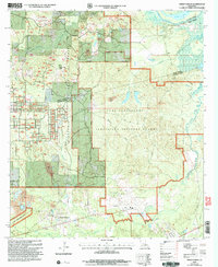
2003 Map of Green Gables
USGS Topo · Published 2005About this map
Kisatchie National Forest dominates this section of Central Louisiana, where the border of Grant and Rapides parishes follows the winding course of the Little River. The landscape is heavily shaped by military and industrial operations, notably the sprawling Camp Beauregard and the Louisiana National Guard reservation. These installations are punctuated by strategic landmarks like Esler Field and various Communication Towers.
Find a feature on this map
32 named features on this map. Tap any name to fly to it.
Don’t see what you’re looking for? This feature index may not catch every label — zoom into the map to look around manually.
Map Details
Editions of this 2003 Green Gables Map
2 editions found
Other maps of this area

1936 · Pollock
USGS Topo · 1:62,500

1941 · Jena
USGS Topo · 1:62,500

1941 · Alexandria
USGS Topo · 1:62,500

1941 · Buckeye
USGS Topo · 1:62,500

1941 · Pollock
USGS Topo · 1:62,500

1953 · Alexandria
USGS Topo · 1:250,000

1955 · Alexandria
USGS Topo · 1:250,000

1957 · Alexandria
USGS Topo · 1:62,500
1957 · Alexandria
USGS Topo · 1:24,000

1958 · Pollock
USGS Topo · 1:62,500