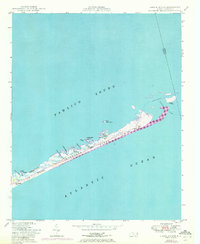
1950 Map of Green Island
USGS Topo · Published 1972About this map
Ocracoke Island serves as the central focal point of this survey, which documents the shifting sands and delicate geography of the Outer Banks shortly after the mid-century. The map captures a transitional period for the Cape Hatteras National Seashore, showing the relationship between the sound and the sea before modern development altered much of the coast. Small-scale human activity is evidenced by Gary Braggs Camp and the Old Green Island Club, while natural features like the Styron Hills and Quork Hammock define the inner landscape of the barrier island. Of particular interest to those studying coastal geomorphology is the detail of Hatteras Inlet and the various creeks and swashes, such as The Great Swash and N Bitterswash Cr, which illustrate the active drainage patterns of this tidal environment between Pamlico Sound and the Atlantic Ocean.
Find a feature on this map
26 named features on this map. Tap any name to fly to it.
Don’t see what you’re looking for? This feature index may not catch every label — zoom into the map to look around manually.
Map Details
Editions of this 1950 Green Island Map
3 editions found
Other maps of this area
1948 · Ocracoke
USGS Topo · 1:24,000

1950 · Howard Reef
USGS Topo · 1:24,000
1950 · Green Island
USGS Topo · 1:24,000

1955 · Wanchese
USGS Topo · 1:250,000

1957 · Manteo
USGS Topo · 1:250,000

1960 · Manteo
USGS Topo · 1:250,000

1985 · Cape Hatteras
USGS Topo · 1:100,000
2002 · Ocracoke
USGS Topo · 1:24,000
2002 · Howard Reef
USGS Topo · 1:24,000
2011 · Hatteras
USGS Topo · 1:24,000