
1952 Map of Green Lake
USGS Topo · Published 1953About this map
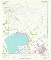
The expansive waters of Green Lake dominate the landscape of the Texas Gulf Coast in the early 1950s, surrounded by a complex network of wetlands and industrial development. This survey reveals the intense mid-century energy activity centered around the Heyser Oil Field in the northwestern quadrant, where numerous Sludge Pits, Flowing Wells, and Oil Wells are interspersed with windmills. The Missouri Pacific railroad cuts a straight line through the territory, serving the small station at Heyser and the community of Green Lake further southeast.
Find a feature on this map
18 named features on this map. Tap any name to fly to it.
Don’t see what you’re looking for? This feature index may not catch every label — zoom into the map to look around manually.
Map Details
Editions of this 1952 Green Lake Map
2 editions found
Other maps of this area

1951 · Bloomington
USGS Topo · 1:24,000

1952 · Tivoli
USGS Topo · 1:24,000

1952 · Bloomington SW
USGS Topo · 1:24,000

1952 · Kamey
USGS Topo · 1:24,000

1952 · Austwell
USGS Topo · 1:24,000

1952 · Seadrift
USGS Topo · 1:24,000

1952 · Port Lavaca West
USGS Topo · 1:24,000

1952 · Placedo
USGS Topo · 1:24,000

1953 · Beeville
USGS Topo · 1:250,000

1956 · Beeville
USGS Topo · 1:250,000