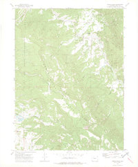
1972 Map of Green Ridge
USGS Topo · Published 1975About this map
Routt National Forest dominates this 1970s landscape, centered on the high divide of Green Ridge. The area is defined by its drainage network, with Little Morrison Creek, Morrison Creek, and Silver Creek carving through the northern terrain, while Wheeler Creek and Beaver Creek flow from the central highlands. The topography is notably steep, as evidenced by The Slide and prominent elevations like Simpson Mountain and Lone Spring Butte.
Find a feature on this map
19 named features on this map. Tap any name to fly to it.
Don’t see what you’re looking for? This feature index may not catch every label — zoom into the map to look around manually.
Map Details
Editions of this 1972 Green Ridge Map
2 editions found
Other maps of this area

1954 · Craig
USGS Topo · 1:250,000

1956 · Walton Peak
USGS Topo · 1:24,000

1956 · Gore Pass
USGS Topo · 1:62,500

1956 · Rabbit Ears Peak
USGS Topo · 1:62,500

1957 · Craig
USGS Topo · 1:250,000

1958 · Craig
USGS Topo · 1:250,000

1960 · Craig
USGS Topo · 1:250,000

1962 · Craig
USGS Topo · 1:250,000

1964 · Craig
USGS Topo · 1:250,000

1965 · Craig
USGS Topo · 1:250,000