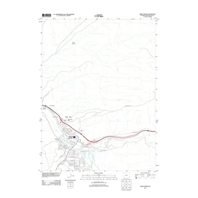
2012 Map of Green River
USGS Topo · Published 2012About this map
Green River sits at the base of dramatic high-desert topography, where the waterway and the railroad share a narrow corridor carved through the plateau. The 2012 landscape is defined by its massive geological sentinels, including Castle Rock, Eagle Rock, and Tollgate Rock, which loom over the town's residential streets and the Riverview Cem. North of the urban center, the terrain opens into a series of canyons and formations like The Palisades and Giants Thumb, while the industrial and transportation routes follow the path of Bitter Cr as it joins the main river. The street grid reflects mid-century expansion into neighborhoods such as Indian Hills, with names like Shoshone Ave and Apache St marking the south side. This survey captures the intersection of heavy infrastructure and the ancient, unchanging landmarks of the Wyoming desert.
Find a feature on this map
50 named features on this map. Tap any name to fly to it.
Don’t see what you’re looking for? This feature index may not catch every label — zoom into the map to look around manually.
Map Details
Editions of this 2012 Green River Map
This is the sole edition of this map. No revisions or reprints were ever made.
Other maps of this area

1954 · Rock Springs
USGS Topo · 1:250,000

1957 · Mc Kinnon Junction
USGS Topo · 1:62,500

1957 · Firehole Basin
USGS Topo · 1:62,500

1958 · Rock Springs
USGS Topo · 1:250,000

1961 · Scott Spring
USGS Topo · 1:24,000

1961 · Peru
USGS Topo · 1:24,000

1961 · Pilot Butte
USGS Topo · 1:24,000

1961 · Austin Ranch
USGS Topo · 1:24,000

1961 · Kanda
USGS Topo · 1:24,000

1961 · Green River
USGS Topo · 1:24,000