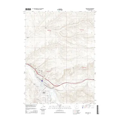
2015 Map of Green River
USGS Topo · Published 2015About this map
Green River occupies a strategic bend where the river meeting Bitter Cr flows beneath a series of iconic geological landmarks. The terrain is defined by dramatic formations such as The Palisades and Tollgate Rock, which have historically served as navigational waypoints for travelers along the valley floor. This 2015 U.S. Geological Survey representation details the modern street grid of the city, including thoroughfares like E Flaming Gorge Way and residential areas extending toward Upland Way. Outside the urban center, the map preserves the alignment of the Old Lincoln Hwy, tracing the path of one of America's earliest transcontinental routes. Local history and genealogy interest is anchored by the Riverview Cem situated near the riverbanks, while the surrounding landscape is dotted with uniquely named features such as Sugar Bowl Rock, Teakettle Rock, and The Towers.
Find a feature on this map
41 named features on this map. Tap any name to fly to it.
Don’t see what you’re looking for? This feature index may not catch every label — zoom into the map to look around manually.
Map Details
Editions of this 2015 Green River Map
This is the sole edition of this map. No revisions or reprints were ever made.
Other maps of this area

1954 · Rock Springs
USGS Topo · 1:250,000

1957 · Mc Kinnon Junction
USGS Topo · 1:62,500

1957 · Firehole Basin
USGS Topo · 1:62,500

1958 · Rock Springs
USGS Topo · 1:250,000

1961 · Scott Spring
USGS Topo · 1:24,000

1961 · Peru
USGS Topo · 1:24,000

1961 · Pilot Butte
USGS Topo · 1:24,000

1961 · Austin Ranch
USGS Topo · 1:24,000

1961 · Kanda
USGS Topo · 1:24,000

1961 · Green River
USGS Topo · 1:24,000