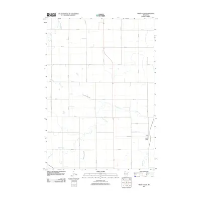
2010 Map of Green Valley
USGS Topo · Published 2010About this map
Green Valley stands as a small agricultural hub amidst the vast prairie grid of Lyon County, situated where the local road network intersects with a significant north-south highway corridor. This area, largely defined by its drainage and irrigation systems, features several vital water management projects such as County Ditch Number Fifteen and County Ditch Number Thirtytwo. These human-engineered channels work in tandem with the natural meandering paths of Threemile Creek and the Yellow Medicine River to support the productive farmland that dominates the region. To the south, the Redwood River cuts across the corner of the map, further emphasizing the importance of water resources to this rural community. The precise grid of section-line roads, including 390th St and 265th Ave, reflects the systematic land organization that has underpinned Minnesota's farming tradition for over a century.
Find a feature on this map
30 named features on this map. Tap any name to fly to it.
Don’t see what you’re looking for? This feature index may not catch every label — zoom into the map to look around manually.
Map Details
Editions of this 2010 Green Valley Map
This is the sole edition of this map. No revisions or reprints were ever made.
Other maps of this area

1953 · New Ulm
USGS Topo · 1:250,000

1957 · New Ulm
USGS Topo · 1:250,000

1958 · New Ulm
USGS Topo · 1:250,000

1962 · Wood Lake NW
USGS Topo · 1:24,000

1962 · Dudley
USGS Topo · 1:24,000

1962 · Cottonwood
USGS Topo · 1:24,000

1963 · Lynd
USGS Topo · 1:24,000

1963 · Marshall
USGS Topo · 1:24,000

1967 · New Ulm
USGS Topo · 1:250,000

1967 · Minneota
USGS Topo · 1:24,000