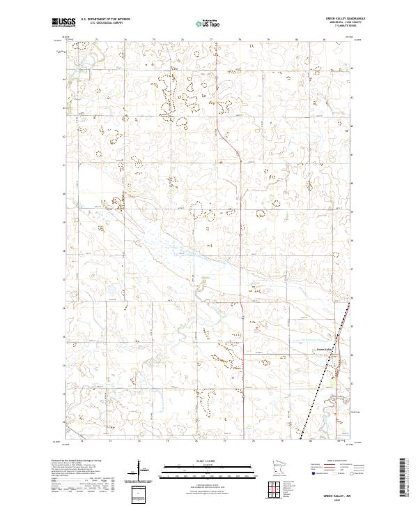
2022 Map of Green Valley
USGS Topo · Published 2022About this map
Green Valley serves as a central point in this part of Lyon County, where the agricultural landscape is defined by an extensive network of managed waterways. The drainage patterns are clearly visible through engineered features like County Ditch Number Fifteen and County Ditch Number Nineteen, which support the productivity of the surrounding prairie. Natural watercourses also meander through the townships, including the Yellow Medicine River in the northwest and the Redwood River in the southeast. This modern survey reflects the enduring grid system of the Public Land Survey System, with roads like CO Hwy 19 and CO Hwy 8 following township and range lines. For those exploring the riverbanks, the Redwood River Trl provides a trace of the local recreation paths near Threemile Cr.
Find a feature on this map
42 named features on this map. Tap any name to fly to it.
Don’t see what you’re looking for? This feature index may not catch every label — zoom into the map to look around manually.
Map Details
Editions of this 2022 Green Valley Map
This is the sole edition of this map. No revisions or reprints were ever made.
Other maps of this area

1953 · New Ulm
USGS Topo · 1:250,000

1957 · New Ulm
USGS Topo · 1:250,000

1958 · New Ulm
USGS Topo · 1:250,000

1962 · Wood Lake NW
USGS Topo · 1:24,000

1962 · Dudley
USGS Topo · 1:24,000

1962 · Cottonwood
USGS Topo · 1:24,000

1963 · Lynd
USGS Topo · 1:24,000

1963 · Marshall
USGS Topo · 1:24,000

1967 · New Ulm
USGS Topo · 1:250,000

1967 · Minneota
USGS Topo · 1:24,000