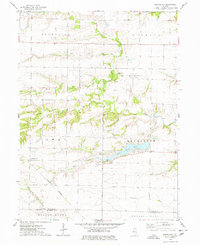
1974 Map of Greenbush
USGS Topo · Published 1978About this map
The boundary of Warren Co Mc Donough Co bisects a landscape defined by the winding tributaries of the E. Fork La Moine River. In this corner of Illinois during the 1970s, the rural community of Greenbush sits at a crossroads north of the man-made Swan Lake, where a local Townhall and the nearby Swan Hills Country Club serve as central landmarks for the surrounding townships. The area is characterized by a high concentration of family and community burial grounds, including Bond Cem, McMahill Cem, and Greenbush Cem, which offer significant value for genealogists tracing local lineage.
Find a feature on this map
26 named features on this map. Tap any name to fly to it.
Don’t see what you’re looking for? This feature index may not catch every label — zoom into the map to look around manually.
Map Details
Editions of this 1974 Greenbush Map
This is the sole edition of this map. No revisions or reprints were ever made.
Other maps of this area

1915 · Avon
USGS Topo · 1:62,500

1916 · Good Hope
USGS Topo · 1:62,500

1918 · Good Hope
USGS Topo · 1:62,500

1921 · Monmouth
USGS Topo · 1:62,500

1923 · Monmouth
USGS Topo · 1:62,500

1925 · Galesburg
USGS Topo · 1:62,500

1927 · Galesburg
USGS Topo · 1:62,500

1944 · Avon
USGS Topo · 1:62,500

1958 · Burlington
USGS Topo · 1:250,000

1961 · Burlington
USGS Topo · 1:250,000