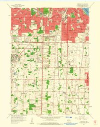
1958 Map of Greendale
USGS Topo · Published 1960About this map
General Mitchell Field anchors the eastern half of this southern Milwaukee landscape, showing the mid-century footprint of the regional airport. The surrounding areas of Greenfield, Franklin, and Oak Creek are in a state of suburban transition, where new residential streets and parks like Jackson Park meet older landmarks. This era is heavily defined by its institutional and spiritual geography, visible in the cluster of large cemeteries such as Forest Home Cemetery and Arlington Cemetery, alongside Catholic educational sites like Alverno College and St Marys Sch.
Find a feature on this map
112 named features on this map. Tap any name to fly to it.
Don’t see what you’re looking for? This feature index may not catch every label — zoom into the map to look around manually.
Map Details
Editions of this 1958 Greendale Map
3 editions found
Other maps of this area

1891 · Bayview
USGS Topo · 1:62,500

1891 · Muskego
USGS Topo · 1:62,500

1892 · Milwaukee
USGS Topo · 1:62,500

1892 · Waukesha
USGS Topo · 1:62,500

1901 · Milwaukee
USGS Topo · 1:62,500

1901 · Waukesha
USGS Topo · 1:62,500

1901 · Bayview
USGS Topo · 1:62,500

1901 · Muskego
USGS Topo · 1:62,500

1906 · Waukesha
USGS Topo · 1:62,500

1906 · Milwaukee
USGS Topo · 1:62,500