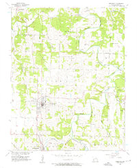
1956 Map of Greenfield
USGS Topo · Published 1957About this map
The county seat of Greenfield serves as the focal point of this mid-century survey, revealing a landscape defined by the winding paths of the Sac River and Turnback Creek. The town's grid is anchored by Toney Park, while the St Louis San Francisco railroad cuts through the southern portion of the quadrangle near South Greenfield and the small settlement of Limestone. This map is particularly valuable for genealogical research, documenting numerous rural burial grounds such as Young Cem, Rose Cem, and Fanning Cem.
Find a feature on this map
38 named features on this map. Tap any name to fly to it.
Don’t see what you’re looking for? This feature index may not catch every label — zoom into the map to look around manually.
Map Details
Editions of this 1956 Greenfield Map
3 editions found
Other maps of this area

1886 · Stockton
USGS Topo · 1:125,000

1886 · Greenfield
USGS Topo · 1:125,000

1888 · Greenfield
USGS Topo · 1:125,000

1954 · Springfield
USGS Topo · 1:250,000

1955 · Dadeville
USGS Topo · 1:24,000
1956 · Kings Point
USGS Topo · 1:24,000

1956 · Greenfield
USGS Topo · 1:24,000
1956 · Lockwood
USGS Topo · 1:24,000
1956 · Bona
USGS Topo · 1:24,000
1956 · South Greenfield
USGS Topo · 1:24,000