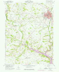
1960 Map of Greenfield
USGS Topo · Published 1976About this map
Greenfield dominates the northeast corner of this 1960s landscape, serving as a concentrated hub for industry and education along the Baltimore and Ohio railroad. The town's institutional footprint is well-defined, featuring McClain High School, McArthur School, and City Hall. Beyond the urban core, the terrain is shaped by the winding courses of Rattlesnake Creek and Paint Creek, which converge in the south toward Paint Lake.
Find a feature on this map
47 named features on this map. Tap any name to fly to it.
Don’t see what you’re looking for? This feature index may not catch every label — zoom into the map to look around manually.
Map Details
Editions of this 1960 Greenfield Map
3 editions found
Other maps of this area

1915 · Bainbridge
USGS Topo · 1:48,000

1917 · Bainbridge
USGS Topo · 1:62,500

1917 · Greenfield
USGS Topo · 1:62,500

1917 · Hillsboro
USGS Topo · 1:62,500

1917 · Sabina
USGS Topo · 1:62,500

1943 · Sabina
USGS Topo · 1:62,500

1944 · Hillsboro
USGS Topo · 1:62,500

1944 · Greenfield
USGS Topo · 1:62,500

1947 · Columbus
USGS Topo · 1:250,000

1960 · Greenfield
USGS Topo · 1:24,000