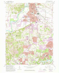
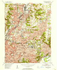
1965 Map of Greenhills
USGS Topo · Published 1975About this map
The Great Miami River flows along the western edge of this suburban and industrial corridor, marking the boundary between the rising hills of St Clair and the expanding residential cores of Hamilton and Fairfield. By the mid-1960s, the landscape shows a dense weave of post-war development and older rural institutions. Pockets of history remain at Huston Cem and scattered local schools like Fairview Sch and St Ann Sch.
Find a feature on this map
73 named features on this map. Tap any name to fly to it.
Don’t see what you’re looking for? This feature index may not catch every label — zoom into the map to look around manually.
Map Details
Editions of this 1965 Greenhills Map
4 editions found
Other maps of this area

1898 · East Cincinnati
USGS Topo · 1:62,500

1904 · Mason
USGS Topo · 1:62,500

1906 · Mason
USGS Topo · 1:62,500

1914 · East Cincinnati
USGS Topo · 1:62,500

1914 · West Cincinnati
USGS Topo · 1:62,500

1915 · Hamilton
USGS Topo · 1:62,500

1917 · Hamilton
USGS Topo · 1:62,500
1953 · Cincinnati East
USGS Topo · 1:24,000

1953 · Cincinnati West
USGS Topo · 1:24,000

1953 · Cincinnati
USGS Topo · 1:250,000