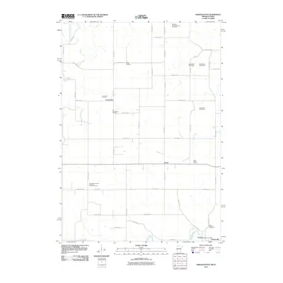
2010 Map of Greenleafton
USGS Topo · Published 2010About this map
Greenleafton and Bristol anchor this 2010 survey of southeastern Minnesota, situated just north of the Iowa state line. The landscape is defined by its deep spiritual and community roots, evidenced by the numerous burial grounds scattered across the township, including the Saetersdal Norwegian Evangelical Lutheran Cemetery and the Old Greenleafton Cemetery. The terrain is drained by the South Branch Root River in the northwest and the Upper Iowa River in the south, with various agricultural improvements such as the East Willow Creek Dam affecting local hydrology.
Find a feature on this map
43 named features on this map. Tap any name to fly to it.
Don’t see what you’re looking for? This feature index may not catch every label — zoom into the map to look around manually.
Map Details
Editions of this 2010 Greenleafton Map
This is the sole edition of this map. No revisions or reprints were ever made.
Other maps of this area

1954 · Mason City
USGS Topo · 1:250,000

1957 · Mason City
USGS Topo · 1:250,000

1958 · Mason City
USGS Topo · 1:250,000

1965 · Greenleafton
USGS Topo · 1:24,000

1965 · Harmony
USGS Topo · 1:24,000

1965 · Wykoff
USGS Topo · 1:24,000

1965 · Fountain
USGS Topo · 1:24,000

1965 · Cherry Grove
USGS Topo · 1:24,000
1965 · Preston
USGS Topo · 1:24,000

1981 · Cresco NW
USGS Topo · 1:24,000