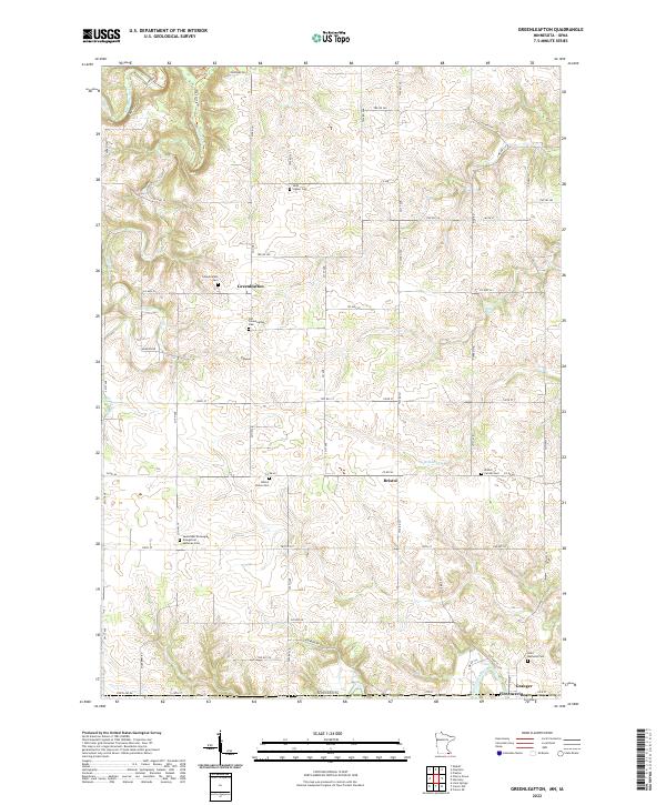
2022 Map of Greenleafton
USGS Topo · Published 2022About this map
Greenleafton and Bristol anchor this agricultural landscape in southern Fillmore County, where the terrain begins its descent toward the Upper Iowa River. The area is notably dense with burial grounds, indicating a deeply rooted community structure from earlier generations of settlement. Genealogists will find a concentration of local history at the Saetersdal Norwegian Evangelical Lutheran Cem, Saint Mathews Cem, and Bristol Grove Cem, among others. The drainage pattern is defined by the Br Root River and Willow Cr, while the village of Granger sits right at the Minnesota border. This survey provides a modern layout of the township roads and county highways that replaced the early pioneer trails, preserving the locations of springs like Crystal Spring and Big Spring Tr that once dictated the placement of farmsteads and small crossroads communities.
Find a feature on this map
67 named features on this map. Tap any name to fly to it.
Don’t see what you’re looking for? This feature index may not catch every label — zoom into the map to look around manually.
Map Details
Editions of this 2022 Greenleafton Map
This is the sole edition of this map. No revisions or reprints were ever made.
Other maps of this area

1954 · Mason City
USGS Topo · 1:250,000

1957 · Mason City
USGS Topo · 1:250,000

1958 · Mason City
USGS Topo · 1:250,000

1965 · Greenleafton
USGS Topo · 1:24,000

1965 · Harmony
USGS Topo · 1:24,000

1965 · Wykoff
USGS Topo · 1:24,000

1965 · Fountain
USGS Topo · 1:24,000

1965 · Cherry Grove
USGS Topo · 1:24,000
1965 · Preston
USGS Topo · 1:24,000

1981 · Cresco NW
USGS Topo · 1:24,000