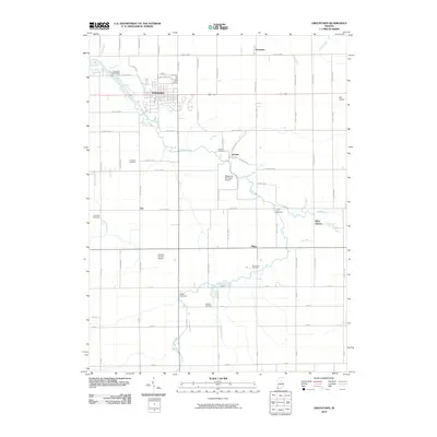
2010 Map of Greentown
USGS Topo · Published 2010About this map
Greentown serves as the primary hub of this Howard County landscape, where the waters of Wildcat Creek and its many tributaries like Pint Run and Rome Run define the local topography. This 2010 survey illustrates a region deeply connected to its agricultural and early settlement roots, evidenced by the numerous cemeteries including Greenlawn Cemetery, Union Civil Cemetery, and the Salem Cemetery located near Turkey Creek. Smaller communities such as Jerome, Phlox, and West Liberty are scattered across a grid of county roads that facilitate travel between local aviation landmarks like the Howard County Airport and Hall Airport. The map also captures the intricate drainage network essential to Indiana's prairie farmlands, featuring man-made and natural courses such as Hopper Ditch, Sims Drain, and Lawn Run which shape the rural boundaries.
Find a feature on this map
78 named features on this map. Tap any name to fly to it.
Don’t see what you’re looking for? This feature index may not catch every label — zoom into the map to look around manually.
Map Details
Editions of this 2010 Greentown Map
This is the sole edition of this map. No revisions or reprints were ever made.
Other maps of this area

1953 · Danville
USGS Topo · 1:250,000

1953 · Muncie
USGS Topo · 1:250,000

1955 · Danville
USGS Topo · 1:250,000

1956 · Muncie
USGS Topo · 1:250,000

1956 · Danville
USGS Topo · 1:250,000

1959 · Miami
USGS Topo · 1:24,000

1960 · Elwood
USGS Topo · 1:24,000

1960 · Point Isabel
USGS Topo · 1:24,000

1960 · Kokomo East
USGS Topo · 1:24,000

1960 · Tipton
USGS Topo · 1:24,000