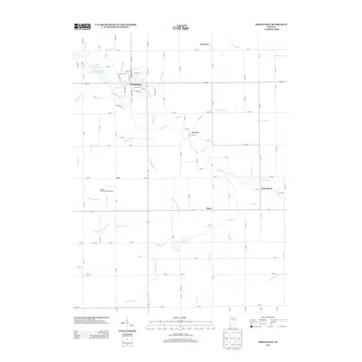
2013 Map of Greentown
USGS Topo · Published 2013About this map
Greentown serves as the primary hub of this eastern Howard County landscape, where the grid of residential streets like N Carter St and E Payton St meets the rural agricultural expanse. The area is defined by an intricate network of waterways managed for drainage and water supply, including the Kokomo Waterworks Reservoir Number Two and the meandering path of Wildcat Cr. Smaller settlements and crossroads communities are scattered throughout the territory, such as Jerome, West Liberty, and Phlox, reflecting a long history of dispersed rural living. The landscape is heavily influenced by hydrology, with numerous named features such as Moon Barclay Ditch, Pint Run, and Lawn Run indicating the management of the tillable land. Transportation is facilitated by a strict section-line road system and the presence of Fowler Field (Private) Airport near the community of Guy.
Find a feature on this map
118 named features on this map. Tap any name to fly to it.
Don’t see what you’re looking for? This feature index may not catch every label — zoom into the map to look around manually.
Map Details
Editions of this 2013 Greentown Map
This is the sole edition of this map. No revisions or reprints were ever made.
Other maps of this area

1953 · Danville
USGS Topo · 1:250,000

1953 · Muncie
USGS Topo · 1:250,000

1955 · Danville
USGS Topo · 1:250,000

1956 · Muncie
USGS Topo · 1:250,000

1956 · Danville
USGS Topo · 1:250,000

1959 · Miami
USGS Topo · 1:24,000

1960 · Elwood
USGS Topo · 1:24,000

1960 · Point Isabel
USGS Topo · 1:24,000

1960 · Kokomo East
USGS Topo · 1:24,000

1960 · Tipton
USGS Topo · 1:24,000