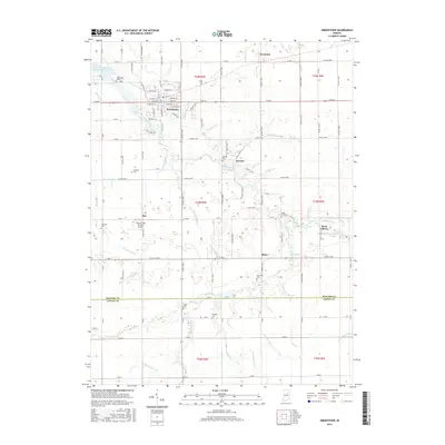
2016 Map of Greentown
USGS Topo · Published 2016About this map
Greentown sits at the northern end of this central Indiana landscape, where the street grid of W Walnut St and E Main St meets the riparian corridors of Wildcat Creek. The surrounding Howard County countryside is defined by an intricate network of agricultural drainage and small rural settlements including Jerome, Phlox, and West Liberty. The map documents a deeply rooted community landscape where family history is anchored by numerous burial grounds such as Union Civil Cem, Salem Cem, and New Hope Cem. The terrain is shaped by an extensive system of waterways, from the Kokomo Waterworks Reservoir Number Two in the northwest to the winding path of Mud Creek in the south. The southern portion of the sheet crosses into Tipton County, revealing a consistent pattern of section-line roads and named watercourses like Turkey Creek and Shockney Ditch that support the region's productive agricultural character.
Find a feature on this map
116 named features on this map. Tap any name to fly to it.
Don’t see what you’re looking for? This feature index may not catch every label — zoom into the map to look around manually.
Map Details
Editions of this 2016 Greentown Map
This is the sole edition of this map. No revisions or reprints were ever made.
Other maps of this area

1953 · Danville
USGS Topo · 1:250,000

1953 · Muncie
USGS Topo · 1:250,000

1955 · Danville
USGS Topo · 1:250,000

1956 · Muncie
USGS Topo · 1:250,000

1956 · Danville
USGS Topo · 1:250,000

1959 · Miami
USGS Topo · 1:24,000

1960 · Elwood
USGS Topo · 1:24,000

1960 · Point Isabel
USGS Topo · 1:24,000

1960 · Kokomo East
USGS Topo · 1:24,000

1960 · Tipton
USGS Topo · 1:24,000