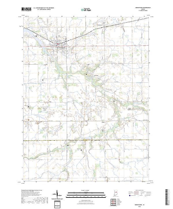
2022 Map of Greentown
USGS Topo · Published 2022About this map
Wildcat Creek and its many tributaries, including Pint Run and Roberts Ditch, define the drainage of this agricultural landscape along the Howard Co Tipton Co line. The town of Greentown serves as the primary hub, showing a grid of residential streets like W Walnut St and E Main St. Scattered throughout the surrounding countryside are several smaller settlements and named points of interest such as Jerome, West Liberty, and Phlox. This map is particularly useful for genealogists, as it identifies numerous local burial grounds including Greenlawn Cem, Salem Cem, and the Union Civil Cem. The region's reliance on managed water systems is evident in the dense network of named drainage features like Moon-Beesley-Ditch and Brunk Ditch, which support the extensive farm tracts that dominate the area.
Find a feature on this map
71 named features on this map. Tap any name to fly to it.
Don’t see what you’re looking for? This feature index may not catch every label — zoom into the map to look around manually.
Map Details
Editions of this 2022 Greentown Map
This is the sole edition of this map. No revisions or reprints were ever made.
Other maps of this area

1953 · Danville
USGS Topo · 1:250,000

1953 · Muncie
USGS Topo · 1:250,000

1955 · Danville
USGS Topo · 1:250,000

1956 · Muncie
USGS Topo · 1:250,000

1956 · Danville
USGS Topo · 1:250,000

1959 · Miami
USGS Topo · 1:24,000

1960 · Elwood
USGS Topo · 1:24,000

1960 · Point Isabel
USGS Topo · 1:24,000

1960 · Kokomo East
USGS Topo · 1:24,000

1960 · Tipton
USGS Topo · 1:24,000