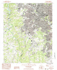
1983 Map of Greenville
USGS Topo · Published 1983About this map
The Saluda River and Reedy River define the industrial and residential corridors of Greenville in the early 1980s. This survey illustrates a dense network of textile-era settlements and mill villages like Woodside and Judson, alongside newer suburban expansions in Sans Souci and Gantt. The city's civic and healthcare infrastructure is prominent, featuring the St Francis Hosp, General Hosp, and Sirrine Stadium. Educational landmarks such as Parker High Sch and Berea High Sch anchor their respective neighborhoods, while the Saluda Dam Powerplant marks a critical point of utility and engineering along the western water boundary. The southern reaches of the map show the expansive Donaldson Center Airport and burgeoning residential clusters like Lakeside and East Gantt, reflecting the transition from the city's traditional core to mid-century industrial and aeronautical developments.
Find a feature on this map
87 named features on this map. Tap any name to fly to it.
Don’t see what you’re looking for? This feature index may not catch every label — zoom into the map to look around manually.
Map Details
Editions of this 1983 Greenville Map
2 editions found
Other maps of this area

1888 · Pickens
USGS Topo · 1:125,000

1894 · Pickens
USGS Topo · 1:125,000

1935 · Greenville
USGS Topo · 1:48,000

1938 · Greenville
USGS Topo · 1:62,500

1954 · Greenville
USGS Topo · 1:250,000

1957 · Greenville
USGS Topo · 1:24,000

1957 · Anderson
USGS Topo · 1:62,500

1957 · Easley
USGS Topo · 1:62,500

1957 · Williamston
USGS Topo · 1:62,500

1957 · Greenville
USGS Topo · 1:62,500