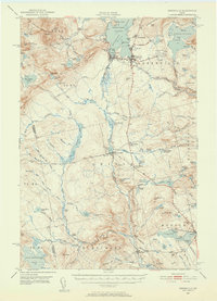
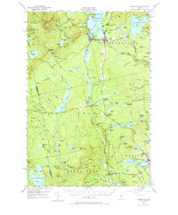
1951 Map of Greenville
USGS Topo · Published 1952About this map
Moosehead Lake anchors the northern reaches of this mid-century survey, serving as a gateway to the Maine North Woods during a period of established rail and aviation transport. The dual presence of the Canadian Pacific and the Bangor and Argostook railroads highlights the region's importance as a hub for timber and tourism, with Greenville Junc acting as a critical intersection. Further south, the map details the industrial and agricultural character of small communities like Shirley Mills and Blanchard, where a Quarry and local schools are noted.
Find a feature on this map
117 named features on this map. Tap any name to fly to it.
Don’t see what you’re looking for? This feature index may not catch every label — zoom into the map to look around manually.
Map Details
Editions of this 1951 Greenville Map
6 editions found

Other maps of this area

1903 · Bingham
USGS Topo · 1:62,500

1905 · Bingham
USGS Topo · 1:62,500

1905 · The Forks
USGS Topo · 1:62,500

1907 · The Forks
USGS Topo · 1:62,500

1920 · Moosehead Lake
USGS Topo · 1:62,500

1921 · Brassua Lake
USGS Topo · 1:62,500

1922 · Moosehead Lake
USGS Topo · 1:62,500

1923 · Brassua Lake
USGS Topo · 1:62,500

1930 · Moosehead Lake
USGS Topo · 1:62,500

1933 · Guilford
USGS Topo · 1:62,500