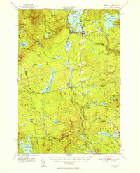
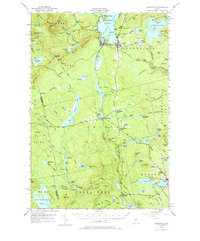
1951 Map of Greenville
USGS Topo · Published 1956About this map
Moosehead Lake dominates the northern reaches of this mid-century survey, anchoring a landscape where industrial transit and wilderness recreation meet. The rail corridor is particularly dense here, featuring the junction of the Bangor and Aroostook Railroad and the Canadian Pacific Railroad near Greenville Junc. This intersection highlights the importance of the region as a gateway for timber and tourism during the early 1950s. To the south, the terrain descends into the headwaters of the Piscataquis River, where small settlements like Shirley Mills and Blanchard sit along the winding riverbanks.
Find a feature on this map
103 named features on this map. Tap any name to fly to it.
Don’t see what you’re looking for? This feature index may not catch every label — zoom into the map to look around manually.
Map Details
Editions of this 1951 Greenville Map
6 editions found

Other maps of this area

1903 · Bingham
USGS Topo · 1:62,500

1905 · Bingham
USGS Topo · 1:62,500

1905 · The Forks
USGS Topo · 1:62,500

1907 · The Forks
USGS Topo · 1:62,500

1920 · Moosehead Lake
USGS Topo · 1:62,500

1921 · Brassua Lake
USGS Topo · 1:62,500

1922 · Moosehead Lake
USGS Topo · 1:62,500

1923 · Brassua Lake
USGS Topo · 1:62,500

1930 · Moosehead Lake
USGS Topo · 1:62,500

1933 · Guilford
USGS Topo · 1:62,500