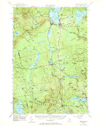
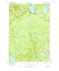
1951 Map of Greenville
USGS Topo · Published 1970About this map
Greenville serves as the focal point of this 1951 survey, situated at the southern tip of Moosehead Lake. The landscape is a complex intersection of logging-era transportation and early recreational infrastructure, where the Canadian Pacific and Bangor and Ar00st00k railroads converge near Greenville June. The map details a transition from the industrial activity at Shirley Mills and the Quarry near Monson to the wilderness of the Piscataquis and Somerset County line. Significant terrain markers like Squaw Mountain and Little Squaw Mountain dominate the western horizon, while the Appalachian Trail winds through the eastern ridges of Elliottsville. Notable local landmarks include the State Fish Hatchery, a Lookout Tower, and several small settlements such as Blanchard and Upper Shirley Corner, providing a look at the mid-century social geography of the Maine North Woods.
Find a feature on this map
135 named features on this map. Tap any name to fly to it.
Don’t see what you’re looking for? This feature index may not catch every label — zoom into the map to look around manually.
Map Details
Editions of this 1951 Greenville Map
6 editions found

Other maps of this area

1903 · Bingham
USGS Topo · 1:62,500

1905 · Bingham
USGS Topo · 1:62,500

1905 · The Forks
USGS Topo · 1:62,500

1907 · The Forks
USGS Topo · 1:62,500

1920 · Moosehead Lake
USGS Topo · 1:62,500

1921 · Brassua Lake
USGS Topo · 1:62,500

1922 · Moosehead Lake
USGS Topo · 1:62,500

1923 · Brassua Lake
USGS Topo · 1:62,500

1930 · Moosehead Lake
USGS Topo · 1:62,500

1933 · Guilford
USGS Topo · 1:62,500