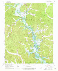
1966 Map of Greenville SW
USGS Topo · Published 1976About this map
St Francis River and the expanding waters of Wappapello Lake dominate this mid-century Missouri landscape, where the valley topography was significantly altered by the impoundment of the river. The map provides a critical look at the relocation of Greenville, showing the settlement's newer position relative to the submerged lands where the Old Greenville Cem remains a significant local landmark. This era of transformation is further documented by the network of family-named burial grounds including Stephens Cem, Hickman Cem, and Wight Cem that dot the ridges above the flood zone.
Find a feature on this map
51 named features on this map. Tap any name to fly to it.
Don’t see what you’re looking for? This feature index may not catch every label — zoom into the map to look around manually.
Map Details
Editions of this 1966 Greenville SW Map
2 editions found
Other maps of this area

1932 · Piedmont
USGS Topo · 1:62,500

1934 · Greenville
USGS Topo · 1:62,500

1934 · Williamsville
USGS Topo · 1:48,000

1935 · Poplar Bluff
USGS Topo · 1:62,500

1935 · Piedmont
USGS Topo · 1:62,500

1939 · Greenville
USGS Topo · 1:62,500

1939 · Poplar Bluff
USGS Topo · 1:62,500

1940 · Williamsville
USGS Topo · 1:62,500

1949 · Rolla
USGS Topo · 1:250,000

1949 · Poplar Bluff
USGS Topo · 1:62,500