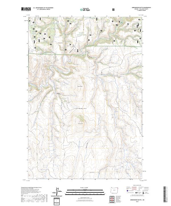
2023 Map of Greenwood Butte
USGS Topo · Published 2023About this map
The high plateau and deep gulches of the Wallowa National Forest define this landscape in the northeastern corner of the state. Small-scale aviation and remote forestry management are evident at the B&H USFS Airport, situated on a relatively level stretch near Poverty Flat. The settlement of Lewis serves as a central point for the local road network, where Lewis Rd and Chesnimnus Creek Rd provide access through the dissected terrain. High points like Greenwood Butte and Haskin Butte rise above a complex drainage system that includes Chesnimnus Creek, Pine Creek, and Peavine Creek. Water management in this high-elevation environment is represented by the Muddy Reservoir and various springs such as McCarty Spring and Spangler Spring. The area's geography is further detailed by numerous named draws including Deadman Gulch and Romaine Gulch.
Find a feature on this map
38 named features on this map. Tap any name to fly to it.
Don’t see what you’re looking for? This feature index may not catch every label — zoom into the map to look around manually.
Map Details
Editions of this 2023 Greenwood Butte Map
This is the sole edition of this map. No revisions or reprints were ever made.
Other maps of this area

1954 · Imnaha
USGS Topo · 1:62,500

1955 · Grangeville
USGS Topo · 1:250,000

1957 · Elk Mountain
USGS Topo · 1:62,500

1959 · Grangeville
USGS Topo · 1:250,000

1963 · Poison Point
USGS Topo · 1:24,000
1967 · Table Mountain
USGS Topo · 1:24,000
1967 · Billy Meadows
USGS Topo · 1:24,000

1980 · Grangeville
USGS Topo · 1:100,000

1982 · Wallowa
USGS Topo · 1:100,000
1990 · Elk Mountain SE
USGS Topo · 1:24,000