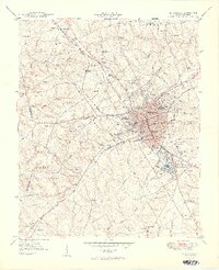
1949 Map of Greenwood
USGS Topo · Published 1949About this map
Greenwood serves as a major textile and rail hub in the late 1940s, defined by its complex network of competing lines including the Southern Railway, the Piedmont And Northern Railway, and the Seaboard Air Line Railway. The city's industrial identity is etched into the landscape through its distinct textile communities, such as Grendel Mill Village, Panola Mill Village, and Mathews Mill Village. Beyond the industrial core, the map reveals a landscape of education and social service, featuring Lander College, the Brewer Normal Institute, and the Connie Maxwell Childrens Home. To the south and west, the terrain transitions into the Sumter National Forest, while small rural settlements like Promised Land and New Market appear alongside numerous country schools and churches like Beulah Ch and Tranquil Ch.
Find a feature on this map
95 named features on this map. Tap any name to fly to it.
Don’t see what you’re looking for? This feature index may not catch every label — zoom into the map to look around manually.
Map Details
Editions of this 1949 Greenwood Map
2 editions found
Other maps of this area

1892 · Abbeville
USGS Topo · 1:125,000

1908 · Kirksey
USGS Topo · 1:24,000

1948 · Abbeville East
USGS Topo · 1:24,000

1948 · Verdery
USGS Topo · 1:24,000

1949 · Ninety-Six
USGS Topo · 1:24,000

1949 · Greenwood
USGS Topo · 1:24,000

1950 · Bradley
USGS Topo · 1:24,000

1950 · Kirksey
USGS Topo · 1:24,000

1950 · Verdery
USGS Topo · 1:24,000

1950 · Abbeville East
USGS Topo · 1:24,000