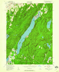
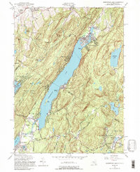
1954 Map of Greenwood Lake
USGS Topo · Published 1960About this map
Greenwood Lake serves as the focal point for this mid-century study, spanning the border between New York and New Jersey. The terrain is defined by the parallel ridges of Belvale Mountain and Warwick Mountain, creating a corridor for early settlement and recreation. To the south, the industrial history of the Ramapo Mountains is evident near Ringwood, where an inactive Iron Mine and the Ringwood Mill sit within the grounds of Ringwood Manor State Park.
Find a feature on this map
52 named features on this map. Tap any name to fly to it.
Don’t see what you’re looking for? This feature index may not catch every label — zoom into the map to look around manually.
Map Details
Editions of this 1954 Greenwood Lake Map
5 editions found
Other maps of this area

1891 · Greenwood Lake
USGS Topo · 1:62,500

1891 · Ramapo
USGS Topo · 1:62,500

1893 · Greenwood Lake
USGS Topo · 1:62,500

1893 · Ramapo
USGS Topo · 1:62,500

1902 · Schunemunk
USGS Topo · 1:62,500

1903 · Greenwood Lake
USGS Topo · 1:62,500

1906 · Goshen
USGS Topo · 1:62,500

1908 · Goshen
USGS Topo · 1:62,500

1910 · Ramapo
USGS Topo · 1:62,500

1910 · Greenwood Lake
USGS Topo · 1:62,500