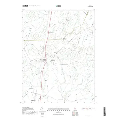
2019 Map of Greenwood
USGS Topo · Published 2019About this map
Saint Johnstown and its historic Saint Johnstown Cem anchor the center of this Delmarva Peninsula landscape, where the headwaters of the Nanticoke River begin to take shape. The area is defined by a dense network of agricultural roads and small watercourses, such as Toms Dam Br and Crony Pond Br, which flow through the low-lying terrain. To the south, the northern reaches of Bridgeville are visible, while the town of Greenwood serves as a central hub for the surrounding rural communities of Owens and Cocked Hat. Aviation is notably present in this rural corridor, with three distinct facilities including Willaview Airport and Sugar Hill Airport. The crossing at Beaverdam Bridge and the boundary between Kent Co and Sussex Co illustrate the long-standing political and physical divisions of this central Delaware region.
Find a feature on this map
112 named features on this map. Tap any name to fly to it.
Don’t see what you’re looking for? This feature index may not catch every label — zoom into the map to look around manually.
Map Details
Editions of this 2019 Greenwood Map
This is the sole edition of this map. No revisions or reprints were ever made.
Other maps of this area

1915 · Seaford
USGS Topo · 1:62,500

1917 · Millsboro
USGS Topo · 1:62,500

1918 · Cedar Creek
USGS Topo · 1:62,500

1918 · Harrington
USGS Topo · 1:62,500

1919 · Cedar Creek
USGS Topo · 1:62,500

1938 · Cedar Creek
USGS Topo · 1:62,500

1938 · Millsboro
USGS Topo · 1:62,500

1944 · Cedar Creek
USGS Topo · 1:62,500

1944 · Millsboro
USGS Topo · 1:62,500

1944 · Seaford
USGS Topo · 1:62,500