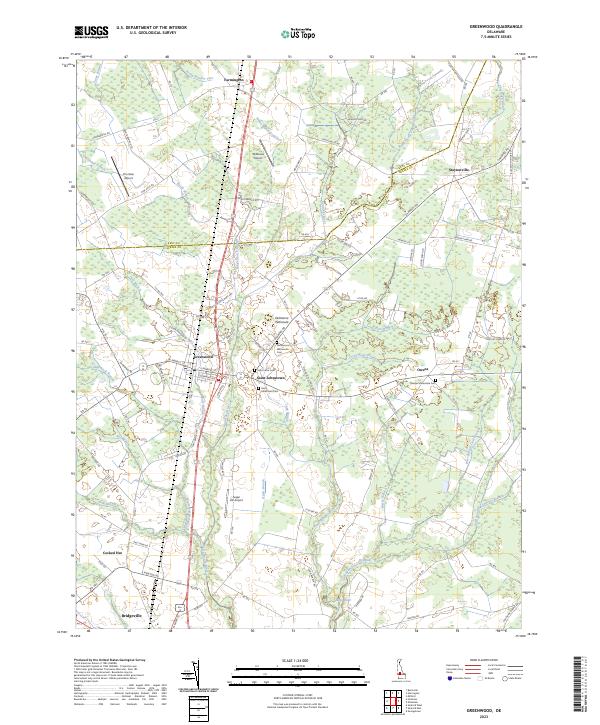
2023 Map of Greenwood
USGS Topo · Published 2023About this map
The Delmarva Peninsula landscape of central Delaware is defined here by the headwaters of the Nanticoke River, where the Kent-Sussex line cuts through a mix of agricultural fields and wooded wetlands. The town of Greenwood serves as a central hub, flanked by the historic crossroads of Saint Johnstown and Staytonville. This area is notable for its concentration of Mennonite heritage, evidenced by the Greenwood Mennonite Cem and Tressler Mennonite Cem. Small regional airstrips like Chorman Airport and Willaview Airport are scattered among the farms, while the terrain is etched by numerous drainage systems including the White Marsh Branch and Marsh Branch. To the south, the settlement of Cocked Hat and the northern edge of Bridgeville appear, connected by a network of rural roads that have served these agricultural communities for generations.
Find a feature on this map
118 named features on this map. Tap any name to fly to it.
Don’t see what you’re looking for? This feature index may not catch every label — zoom into the map to look around manually.
Map Details
Editions of this 2023 Greenwood Map
This is the sole edition of this map. No revisions or reprints were ever made.
Other maps of this area

1915 · Seaford
USGS Topo · 1:62,500

1917 · Millsboro
USGS Topo · 1:62,500

1918 · Cedar Creek
USGS Topo · 1:62,500

1918 · Harrington
USGS Topo · 1:62,500

1919 · Cedar Creek
USGS Topo · 1:62,500

1938 · Cedar Creek
USGS Topo · 1:62,500

1938 · Millsboro
USGS Topo · 1:62,500

1944 · Cedar Creek
USGS Topo · 1:62,500

1944 · Millsboro
USGS Topo · 1:62,500

1944 · Seaford
USGS Topo · 1:62,500