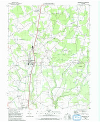
1992 Map of Greenwood
USGS Topo · Published 1992About this map
Greenwood sits as a central hub on the Delmarva Peninsula in the early 1990s, where the Conrail line parallels the Nanticoke River through a landscape of timber and agriculture. This region, straddling the Kent Co Sussex Co line, reveals a network of small agricultural settlements and historic institutions including the St Johnstown Ch and the Woodbridge Sch. To the east, the Ellendale State Forest preserves a significant portion of the local woodlands, while curiously named land features like Devils Woodyard and Cocked Hat speak to the area's deep-rooted vernacular geography.
Find a feature on this map
47 named features on this map. Tap any name to fly to it.
Don’t see what you’re looking for? This feature index may not catch every label — zoom into the map to look around manually.
Map Details
Editions of this 1992 Greenwood Map
This is the sole edition of this map. No revisions or reprints were ever made.
Other maps of this area

1915 · Seaford
USGS Topo · 1:62,500

1917 · Millsboro
USGS Topo · 1:62,500

1918 · Cedar Creek
USGS Topo · 1:62,500

1918 · Harrington
USGS Topo · 1:62,500

1919 · Cedar Creek
USGS Topo · 1:62,500

1938 · Cedar Creek
USGS Topo · 1:62,500

1938 · Millsboro
USGS Topo · 1:62,500

1944 · Cedar Creek
USGS Topo · 1:62,500

1944 · Millsboro
USGS Topo · 1:62,500

1944 · Seaford
USGS Topo · 1:62,500