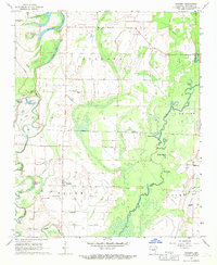
1968 Map of Gregory
USGS Topo · Published 1970About this map
The Cache River winds through this Woodruff County landscape, defining a complex network of wetlands and oxbow lakes such as Horseshoe Lake, Three Prong Lake, and Beard Lake. The settlement of Gregory serves as a local hub, flanked by the Mary Stanley Landing Strip and several rural congregations, including Harris Chapel and St Paul Ch. This late 1960s survey illustrates a region shaped by its proximity to the river, where agriculture and aviation meet the swampy bottomlands of the Augusta and De View districts.
Find a feature on this map
36 named features on this map. Tap any name to fly to it.
Don’t see what you’re looking for? This feature index may not catch every label — zoom into the map to look around manually.
Map Details
Editions of this 1968 Gregory Map
3 editions found
Other maps of this area

1935 · Augusta
USGS Topo · 1:62,500

1935 · Gregory
USGS Topo · 1:62,500

1939 · Hunter
USGS Topo · 1:62,500

1940 · Tilton
USGS Topo · 1:62,500

1953 · Memphis
USGS Topo · 1:250,000

1956 · Memphis
USGS Topo · 1:250,000

1956 · Tilton
USGS Topo · 1:62,500

1956 · Hunter
USGS Topo · 1:62,500

1957 · Augusta
USGS Topo · 1:62,500

1957 · Gregory
USGS Topo · 1:62,500