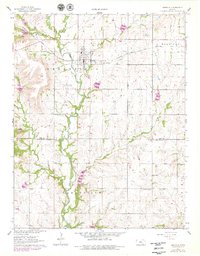
1962 Map of Grenola
USGS Topo · Published 1979About this map
Grenola serves as the central hub of this Kansas landscape, situated where the Atchison Topeka and Santa Fe railroad crosses the plains of Greenfield and Caneyville townships. The map documents a period of significant petroleum activity, with numerous oil wells and an oil well scattered across the creek-cut terrain. The topography is defined by the winding course of the Caney River and its tributaries, including Wolf Creek, Wild Cat Creek, and Spring Creek.
Find a feature on this map
18 named features on this map. Tap any name to fly to it.
Don’t see what you’re looking for? This feature index may not catch every label — zoom into the map to look around manually.
Map Details
Editions of this 1962 Grenola Map
2 editions found
Other maps of this area

1885 · Sedan
USGS Topo · 1:125,000

1889 · Burden
USGS Topo · 1:125,000

1889 · Sedan
USGS Topo · 1:125,000

1955 · Wichita
USGS Topo · 1:250,000

1958 · Wichita
USGS Topo · 1:250,000

1962 · Moline
USGS Topo · 1:24,000

1962 · Grand Summit
USGS Topo · 1:24,000

1962 · Elgin NE
USGS Topo · 1:24,000
1962 · Cloverdale
USGS Topo · 1:24,000
1962 · Dexter NE
USGS Topo · 1:24,000