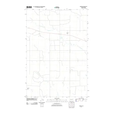
2011 Map of Griffin
USGS Topo · Published 2011About this map
Griffin serves as a central point of reference in this Bowman County landscape, situated along the path of Route 12. The terrain is defined by the winding drainages of Spring Creek, Cold Turkey Creek, and Alkali Creek, which create a complex hydrological network across the prairie. To the southwest, the elevated landforms of the Medicine Pole Hills provide a distinct geographic break from the surrounding plains.
Find a feature on this map
9 named features on this map. Tap any name to fly to it.
Don’t see what you’re looking for? This feature index may not catch every label — zoom into the map to look around manually.
Map Details
Editions of this 2011 Griffin Map
This is the sole edition of this map. No revisions or reprints were ever made.
Other maps of this area

1953 · Dickinson
USGS Topo · 1:250,000

1957 · Dickinson
USGS Topo · 1:250,000

1968 · Bowman SW
USGS Topo · 1:24,000

1968 · Bowman
USGS Topo · 1:24,000

1973 · Camel Butte
USGS Topo · 1:24,000
1973 · Rhame SE
USGS Topo · 1:24,000

1973 · Stewart Lake
USGS Topo · 1:24,000

1973 · Griffin
USGS Topo · 1:24,000

1973 · Rhame
USGS Topo · 1:24,000

1979 · Ives
USGS Topo · 1:24,000